Impacts and Drivers of “Sou’easter” Extratropical Cyclones
Understanding atmospheric drivers and coastal impacts of extratropical cyclones with southeasterly winds.
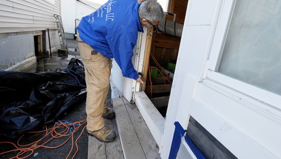
Extratropical cyclones that produce sustained winds out of the southeast, sometimes called “sou’easters”, can produce damaging wind, surge, waves, and rainfall along Maine’s coast. Three storms in December 2023 and January 2024 featured this wind pattern and caused at least $90 million in public infrastructure damage across the state. We are partnering with the National Weather Service to examine the atmospheric circulation patterns and storm tracks associated with sou’easters, as well as their impacts to Gulf of Maine communities from storm surge, waves, and precipitation.
Project Goals:
- Develop a catalog of historical sou’easter extratropical cyclones using wind station data across Maine.
- Analyze the storm tracks and atmospheric circulation patterns associated with sou’easters and examine their links to climate modes (i.e. North Atlantic Oscillation, El Nino Southern Oscillation, etc.).
- Investigate how extratropical cyclone storm tracks and atmospheric circulation patterns affect precipitation, waves, storm surge, and the amplification of surge within estuaries.
- Increase community knowledge of sou’easters.
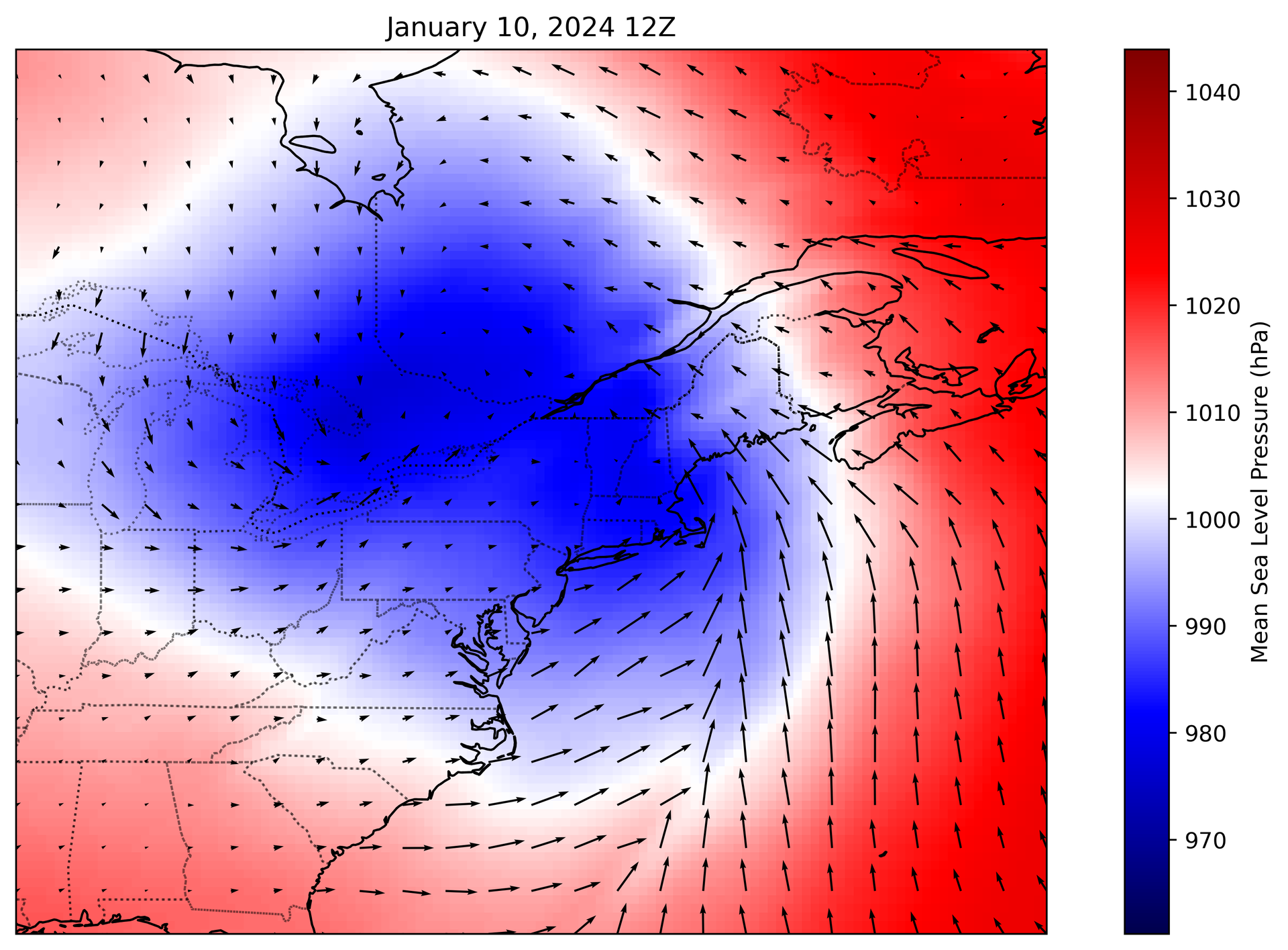
Maine’s northeast-southwest oriented coastline is vulnerable to damaging impacts from coastal storms with southeasterly winds. Extratropical cyclones that produce this wind direction, colloquially called “sou’easters”, can drive ocean water shoreward and generate large, damaging waves, as demonstrated by the January 10 and 13, 2024 storms.
They can also bring warm, moisture-laden air up from lower latitudes that drives heavy precipitation across New England, as was the case with the December 18, 2023 storm that drove catastrophic inland flooding across the Kennebec, Androscoggin, and Saco River watersheds.
Gaining insight into the atmospheric patterns that precede these events and the coastal impacts that follow can improve forecasting and community preparedness.
This project develops a historical catalog of sou’easters from 1950 to the present, with the goal of characterizing their associated atmospheric circulation patterns and coastal impacts. We examine the locations of troughs and ridges in the atmosphere, characteristic storm tracks (often located farther inland than the typical “nor’easter” extratropical cyclones that produce northeasterly winds), and connections to large-scale modes of climate variability such as the North Atlantic Oscillation and El Niño Southern Oscillation. We are also using tide gauge records, wave buoy records, and the NOAA Coastal Ocean Reanalysiscoastal and atmospheric reanalysis datasets to examine the effect of storm wind direction on precipitation, storm surge, waves, and estuarine surge amplification in the Gulf of Maine region. By deepening our understanding of the drivers and impacts of sou’easters, we aim to bridge scientific insights with community action to prepare coastal Maine communities for their impacts.
Learn more about extratropical cyclones here.
Project Team
Project Partner
Read more
-
Coastal Storms 101
Learn about the forces behind coastal storms, their unique impacts on the Gulf of Maine, and how communities are working to adapt.
Explainers
-
It's time for Northeast to prep for floods like those that hit this winter. Climate change is why
Scientists say the back-to-back storms that lashed the Northeast in January were more of a sign of things to come than an anomaly.
Press Clips
-
Marine Heatwaves 101
Learn about what marine heatwaves are and how they can disrupt coastal ecosystems and the communities that depend on them.
Explainers
-
20 Years on the Waterfront: Reflecting & Looking Ahead
Celebrating our collective journey toward a thriving future
Perspectives